วันศุกร์ที่ 9 พฤศจิกายน พ.ศ. 2550

UNESCO Biosphere Reserves

A Biosphere Reserves has three functions :
1. a conservation function, contributing to the conservation of landscapes, species and genetic variation,
2. a development function, fostering economic development which is ecologically and culturally sustainable,
3. a logistic support function for research, education, training and monitoring.
Biosphere Reserves are organized into 3 inter-related zones in order to enable them to carry out the different activities involved :
a core area for the long-term protection of biodiversity,
a buffer zone around or next to the core used for recreation, education, research and sustainable resource use, complatible with the ecosystem conservation objectives,
an outer transition area used for agriculture and other rural activities, including human settlements. It is here that the local communities, nature conservation agencies, scientists, non-governmental organizations, cultural groups, and other stakeholders work together to manage and develop the area resources in a sustainable manner.

Why are the mangrove forests important?

No mangroves : No fish

No mangroves : No prawns

No mangroves : No mud crabs

Mangrove trees provide a source of food for many marine animals. They also provide shelter from predators in their complex root systems for young shrimp, crabs and fish. In this way, mangrove forests support Ranong's fishing industry, providing employment, food and other economic benefits for a large number of people.

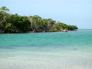
No mangroves - no wood
Mangroves are an important source of wood which local people use to construct their houses and fishing equipment as well as for cooking fuel.

No mangroves, no coastal protection

Mangrove forests protect the coast from erosion during the Southwest monsoon. In areas where mangroves have been cut back the coastline erodes each year exposing villages to storm damage.

Mangroves-seagrass - coral reefs linkage
Mangroves maintain coastal water quality by trapping sediments and filtering nutrients carried down by river systems. This is important for seagrass and coral reefs growing offshore as they grow best in clean/clear water.

วันเสาร์ที่ 22 กันยายน พ.ศ. 2550

The World War 2 japanese

The History of the WW II Japanese Military Base and Railway at Khao Fachi Village, La-un
District, Ranong, Thailand. Before 1941, the village of Khao Fachi, the banks of the La-un canal, where the La-un community (30 km.) is now located, were rich with mangrove forest. Royal Highway Petchkasem no.4 ended at the La-un canal. There was no bridge to cross the canal and Ranong was reached by boat. In fact, in 1941 Ban Bangland village, 3 kilometres northwest of Khao Fachi had only 5 houses. On December 8th 1941 the Japanese army landed, at Parknam Chumpon, or the mouth of the Chumpon River, and began to move their soldiers ashore. As they then advanced to seize and occupy Burma they met resistance from volunteer soldiers, mainly young people, students and villagers from the southern provinces of Thailand. Many people were killed or injured on both sides of the fighting. But the Japanese were too powerful and an agreement was made between Japan and the Thai government for the resistance to stop. The Japanese moved quickly and had captured Victoria Point in Burma by the end of December 1941. To achieve this the Japanese first moved their infantry along Royal Highway no. 4. They followed the route between Chumpon, Kraburi, the La-un canal and Petchakasem. Because of the difficult terrain, with narrow and steep winding paths, it was not easy to move troops and supplies and heavy weapons could not be transported along this route. Therefore, the idea of constructing a railway parallel to highway no.4 was formed.

The Military Headquarters at Khao Fachi At first, after landing at Chumpon the Japanese forces looked for a suitable place to set up their headquarters. They established Khao Fachi village (the present Bang Kaew community) as their military headquarters. This became an important base of a number of bases set up along the Andaman coast. The position was important because troops and supplies could be moved by land, sea and air to strengthen their hold on the region. Two methods were used to move forces to Burma. By land from Champon and along the Petchkasem Highway, and also by ship via the Straits of Malacca and then up the Andaman Sea. Ships were anchored to the south of Victoria Point, or Kothong, and troops, equipment and supplies transferred to the shore on small boats. From the mouth of the Kraburi river the boats moved north by Ko Yao and Ko Kwang islands and entered the La-un canal only 7 kms away.Khao Fachi military base covered an area of 7 square kilometres. The buildings were mainly constructed of wood and had tin roofs. The headquarters was established at the top of a mountain, at a height of 259 metres. This gave the soldiers a commanding view over the surrounding countryside and from here they were able to observe enemy movements on land, sea and air. The River Kraburi, the La-un canal and the Kema Yai and Maliwan canals in Burma could all be seen from this vantage point.Today, there remains one rubber tree on top of the mountain, but in 1941 there were two tall trees. From these trees the soldiers used telescopes to observe the enemy.


Anti aircraft guns were situated around the garrison and were used when allied aircraft from Burma bombed and attacked the base with machine guns. For protection the Japanese surrounded the base with air raid shelters and trenches. Camouflaged accommodation for the commissioned and non-commissioned officers was situated in the valley. The camp also had its own water storage systemand a well. The soldier’s quarters were at the foot of the mountain and here were underground prisons to hold prisoners of war. The prisoners were mainly Malaysian Indian but included some Thai people. To the south of the La-un canal the low-lying plane was covered by mangrove swamp, which at times was submerged by seawater. The prisoners of war were used for construction work. This forced labour excavated and levelled the area for buildings and roads. A wooden warehouse (1) was built next to the La-un canal and a quay (2) was constructed, against which boats were moored. The warehouse was used to store food, fuel and military equipment, (but not weapons and ammunition). These supplies were brought to the warehouse by trains and boats. Fresh water for the boats was taken to the quay, from the storage tanks at Khao Fachi, along a 400metre pipeline. Alongside the quay, buildings (3) were constructed to house labourers and prisoners of war. The complex also included a hospital (4), kitchens and dining halls (5) and a railway station (6). This railway station was the most southerly of the military stations. The double railway track allowed the wood-fuelled steam locomotives to make a U-turn and return north. To the north of the station, near where La-un Wittayakarn School is now situated, was the graveyard. Here the many prisoners and labourers who died during construction of the railway were buried.Front line troops were located at Kho Kwang Island and Khao Hua Kang. At Kraburi River, on Kho Kwang Island, a lookout post was established where the Japanese could observe and control ship movements. The island had a maze of air raid-shelters, trenches and tunnels. Large defensive guns were also located here.Khao Hua Kang at La-un canal was the rear guard post. Its purpose was to offer further resistance if the attacking enemy got passed Ko Kwang Point.The base at Khao Hua Kang was similar to that at Kho Kwang with gun emplacements and air-raid shelters. A 15 km bamboo walkway across the mangrove forests between Khao Hua Kwang Point and Khao Fachi military base was constructed, along which the Japanese soldiers marched.The RailwayThe Chumpon- Kra Buri - La-un Railway was constructed to transport soldiers, arms and supplies from the Chumpon Province to the Andaman Sea.Surveying of the railway route began on May 16th 1943. Japanese Lieutenant-Colonel Kumota and Thai Major Prince Chidchanok with a staff of 15 people carried out the survey. The line ran parallel to the Chumpon-Kra Buri highway to the La-un canal some 90 km away. On May 31 1943 an agreement was signed, between the Thai Supreme Commander and the Commander of the Japanese Army, for the construction of a railway through the Kra Isthmus. The shortage of labour was a major problem because the majority of Thai villagers were employed in other areas of the war. No heavy earth moving equipment was available and the excavation relied heavily upon manual labour provided by Malaysian and Chinese workers. Thai carpenters were used for the construction of the wooden bridges.Work on the railway commenced in June 1943 and the rails had been laid by November 1943. Prisoners of war and labourers were brought by train from Chumpon Railway Station. They were then marched a long distance to the construction sites. Many of these workers died from disease. Some of the prisoners escaped to Petchaburi and survived by begging for food from villagers on the way. Prisoners that were recaptured by the Japanese were treated very harshly and returned to prison. The Engineer in Charge of the railway construction was Colonel Ongawa, he later changed his name to Ichui. The Chief Mechanic was Mr Kamahachi. Railway sleepers and bridges were made from wood and in total 31 bridges were constructed along the route. The track gauge was 56.5 inches, the same as in Malaysia. The rails themselves were brought from Kalantan in Malasia and were transported to the construction sites on freight wagons. The radius of the curves varied between 400 and 1000 metres. On the entire route there were 137 curves, and 8 cuttings were driven through the landscape. The railway began south of Chumpon at 4469+805.30 km. Along the length of the railway were 7 more stations. These were at Wangpai, Parkjan, Tablee, Kra Buri, Klong Lamlieng and Khao Fachi. The material used in the building of the stations was mainly wood and bamboo.

The weapons and supplies were initially transported in railway carriages pulled by trucks adapted to run along the rails. On reaching Khao Fachi the goods were unloaded and transferred to boats for
further transport along the La-un canal to the River Kra Buri and hence on to Victoria Point. The Japanese used the railway for just 11 months. Heavy use of the track ceased when, on March 19th 1945, at between 2 pm and 6 pm, 30 heavy allied bombers attacked the railway and the base at Khao Fachi. Severe damage was caused, destroying part of the track, and sinking boats and supply ships on the La-un canal. In June 1945, the Japanese dismantled a part of the track, between 28 and 30 km from Khao Fachi quay. The sections were used to repair the damaged track further south. Attempts were made to keep the railway open, but further allied air attacks meant that it could no longer be used for transporting heavy weapons. Only food and light equipment could be moved along it to the soldiers at Victoria Point.The Japanese surrendered on 10th August 1945 and their army was disarmed. British soldiers dismantled the railway and the rails were returned to Kalantan, Malasia. Today, only traces from the path of the railway can be seen running alongside the Petchkasem Highway.Although the railway had been built and used throughout the war only a very few Thai people know of its existence.
60 years after the Japanese occupation and the building of the railway, very few of the young Thai generation are aware that at one time Khao Fachi had been crowded with Japanese soldiers and prisoners of war. Now, the remains of guns, ammunition, mortar bombs, samurai swords and the tunnels, trenches and underground shelters are just some of the evidence bearing testimony to the existence of the WWII Military Base. As for the railway, there are overgrown paths, rusty tracks, decaying sleepers, and sadly, the remains of those who died. Wrecks of sunken ships still lie on the seabed. And in Khao, Fachi the well is still there, and used by today’s villagers. The history and evidence of these events are to be studied and preserved for future generations. Memories, from the tragedy of war, will lead to lasting peace for humanity.

About Ranong

Ranong is located 586 kilometers south of Bangkok and is the fist southern province that is located on the Andaman Sea. It compasses an area of 3,298 square kilometers, with length from north to south 169 kilometers and the narrowest part of only 44 kilometers, hence the name
"Isthmus of the Malaysia Peninsular"
Ranong is renowned for the wettest province in Thailand, this is the result of the monsoon influence which brings with it the abundance rainfall. The province economy is very diverse, ranging from tin mining in the past to white clay extraction for the production of porcelain. Fishing industry still plays a vital role in the present date economy. Rubber and cashewnut production are an important agriculture product of the province.
The province administration is divided into 4 districts and 1 sub-district. "Muang Ranong" District is the largest which is the town center and its vicinity, others are "La-un" District to the east, "Kra-Buri" District to the north and "Ka-Pur" District to the south.
Ranong is Thailand's least populous province and the land area is 80% forest and 67% mountains terrain. Like much of Southern Thailand west coast, it undergoes monsoon season from June till October and the best time to visit Ranong is between November and May for island hopping and to discover the magnificent under water world. However the during the monsoon period the mountains surrenders spectacular and breath taking scenery. A letter writer who stopped over during the height of the rainy season decided that Ranong must be a correction of the English 'rained On'! Actually it's pronounced 'ra-nawng'.

วันศุกร์ที่ 21 กันยายน พ.ศ. 2550

History

Khaw Soo Cheang was a Chinese from Zhangzhou-fu, Fukien Province, who tried his luck abroad. In 1810 he arrived at Penang, but after 6 unsuccessful years he came to Takuapa to try his luck there. Earning well from various trading activities, in 1844 he was appointed Royal Collector of tin royalties in the Ranong area, and receiving the title and name Luang Ratanasethi. 1854 King Mongkut made him governour of Ranong and elevated him to Phra. At that time Ranong was a subordinate of the Chumphon province, but in 1864 due to the good performance of the governour it was elevated to full provincial status, and he became the title Phraya. After he died in 1882 his second son became the new governour and in 1896 commissioner of Monthon Chumphon, other sons became governour of Kra, Langsuan, and his youngest son Kho Sim Bee became governour of Trang, and in 1900 commissioner of Monthon Phuket. However after his death in 1913 a commissioner from outside the area was appointed, to stop the traditionally inherited administrative power of the family. In 1916 all Chinese immigrants and their descendants had to adopt a Thai name, and the family of Khaw Soo Cheang became the Na Ranong family.